It’s A Small World After All: 35+ Tiny Nations, Territories, And Settlements
People assume the Polynesian and Pacific islands are home to the smallest nations in the world. And while they’re not wrong, there are dozens of nations, both island and land-locked, that are just as small as your hometown (assuming you didn’t grow up in NYC). Consider Monaco, which has a population of a little over 30,000 and is known as a haven for the wealthy and famous. Though Liechtenstein has a population of 39,000, it’s still a tiny village compared to other European nations.
Join us as we go on a world tour of the often-overlooked nations that a lucky few [thousand] can call home. As you go through, you’ll see why size doesn’t always matter—be it population or square kilometers.
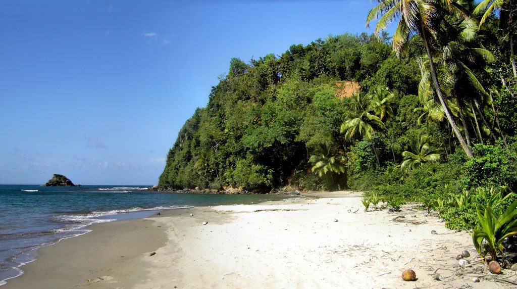
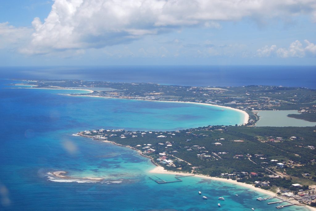
The Bahamas (Population: 413,623)
Lucayan Indians lived on these islands when Columbus set sail for the new world. In 1647, the islands were first settled by the British, and in 1783 they were given colonial status. Since gaining independence in 1973, the Bahamas have profited via tourism, international finance, and capital management.
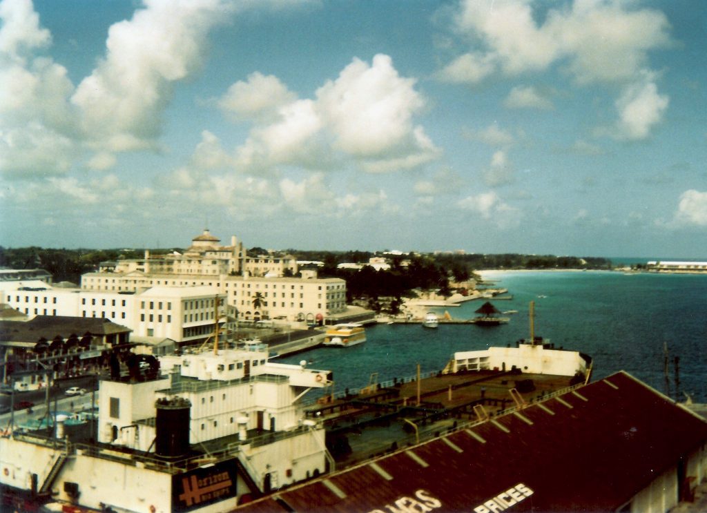
These three industries account for up to 85% of the country’s economy. In addition, US law enforcement organizations team up with their counterparts in The Bahamas. Operation Bahamas, Turks, and Caicos, or OPBAT, is the US Coast Guard’s contribution to Bahamian maritime security and law enforcement.
Belize (Population: 410,825)
During the 17th and 18th centuries, the British and Spanish fought over control of the area in Belize. In 1862, it officially became a colony of British Honduras. Britain and Guatemala had territorial issues that prevented Belize from declaring its freedom until 1981.
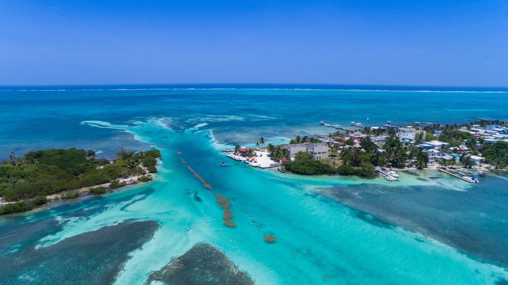
A border issue existed between Guatemala and the newly-formed country, and the former only acknowledged Belize in 1992. But things were by no means settled. Thirty years later, both countries took their border dispute to the International Court of Justice for final adjudication.
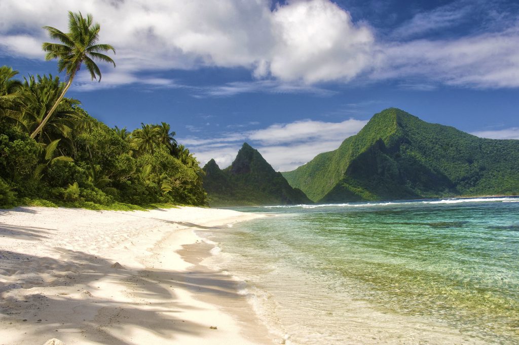
Vanuatu (Population: 334,506)
Officially known as the Republic of Vanuatu, this island nation in the southwest Pacific Ocean is made up of a chain of 13 major islands and numerous smaller ones. The islands span 400 kilometers from north to south. Vanuatu gained its independence in 1980.
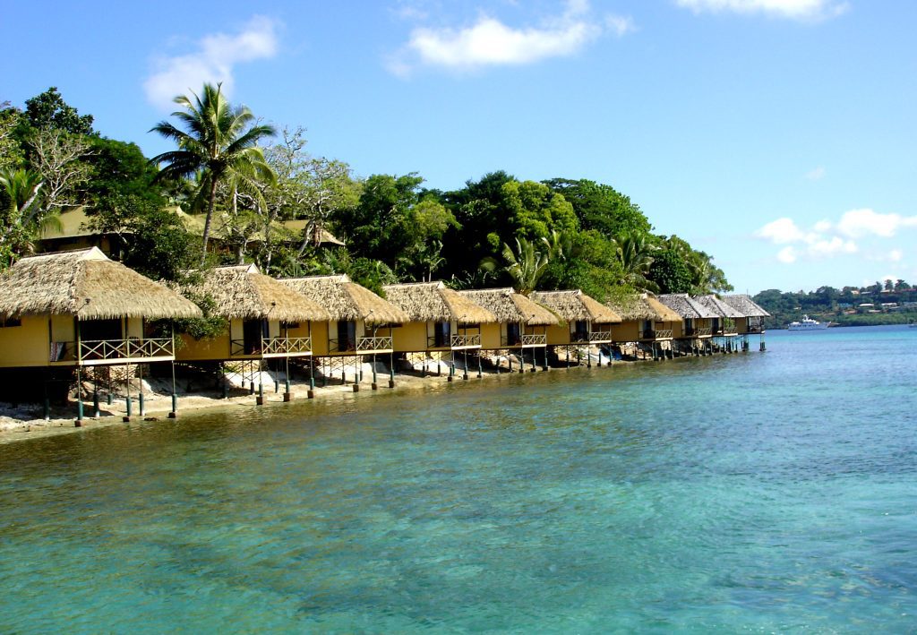
Before then, it was ruled by the jointly governed Anglo-French condominium of the New Hebrides. In several of the Melanesian tongues spoken there, the term Vanuatu translates to “Our Land Forever.” Port-Vila (Vila), on Éfaté, is the biggest city, the country’s capital, and its commercial hub.
New Caledonia (Population: 292,991)
New Caledonia is a French autonomous territory located 900 miles east of Australia in the southwest Pacific Ocean. It contains the Loyalty and the Bélep Islands, the Île des Pins, as well as the island of New Caledonia, which is home to Nouméa—the nation’s capital.
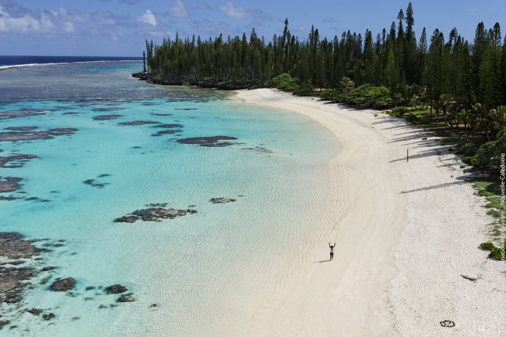
About 99% of the nation’s surface is made up of the aforementioned islands. Nine-tenths of the people live on the main island, Loyalty Island, which is by far the biggest of the bunch. The lagoons of New Caledonia were named a UNESCO World Heritage site in 2008.
Barbados (Population: 281,995)
Measuring a total of 169 square kilometers, Barbados was home to two indigenous peoples before the British arrived in 1627. Shortly thereafter, the island had multiple sugar plantations that made it a dominant player in the Caribbean sugar industry, though it lost its top spot by 1720.
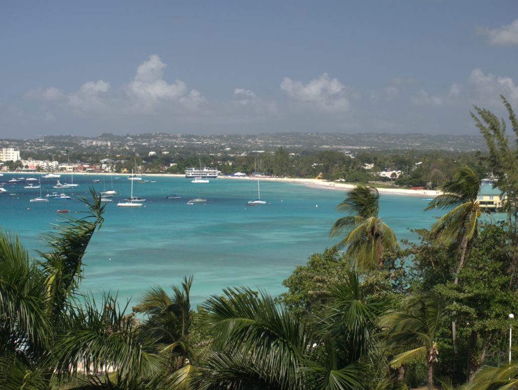
Full independence from the UK was achieved in 1966 as a result of the slow evolution of political and social changes in the 1940s and 1950s. With regard to economic significance, the sugar sector was superseded in the 1990s by industry and tourism.
Sao Tome and Principe (Population: 231,856)
In the late 15th century, Portugal “found” and occupied these remote islands, establishing a sugar-based industry that ultimately led to cocoa and coffee in the 19th century. All of these commodities were farmed using African estate slave labor, a practice that persisted into the 20th century.
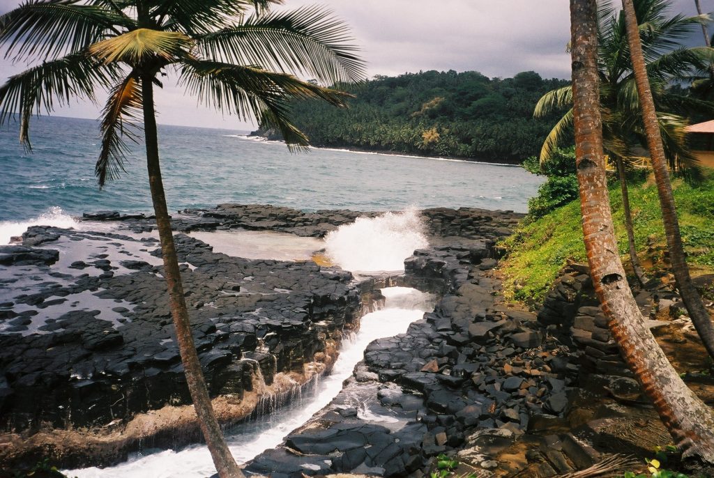
Although they gained independence in 1975, democratic changes were not put into place until about the late 1980s. In 1991, the nation conducted its first-ever open elections. Recently, there’s been increased interest in the tiny island nation, possibly due to recent oil finds in the Gulf of Guinea.
Samoa (Population: 225,681)
As a nation, Samoa started attempting to link itself quite tightly with New Zealand and Australia in the late 2000s. For starters, Samoa switched to driving on the left side of the road in 2009 to conform to those of other Commonwealth nations.
In addition, Samoa moved to the western side of the International Date Line in 2011, bypassing December 30, and is now one hour in advance of New Zealand as well as three hours in advance of Australia’s east coast instead of 23 and 21 hours behind, respectively.
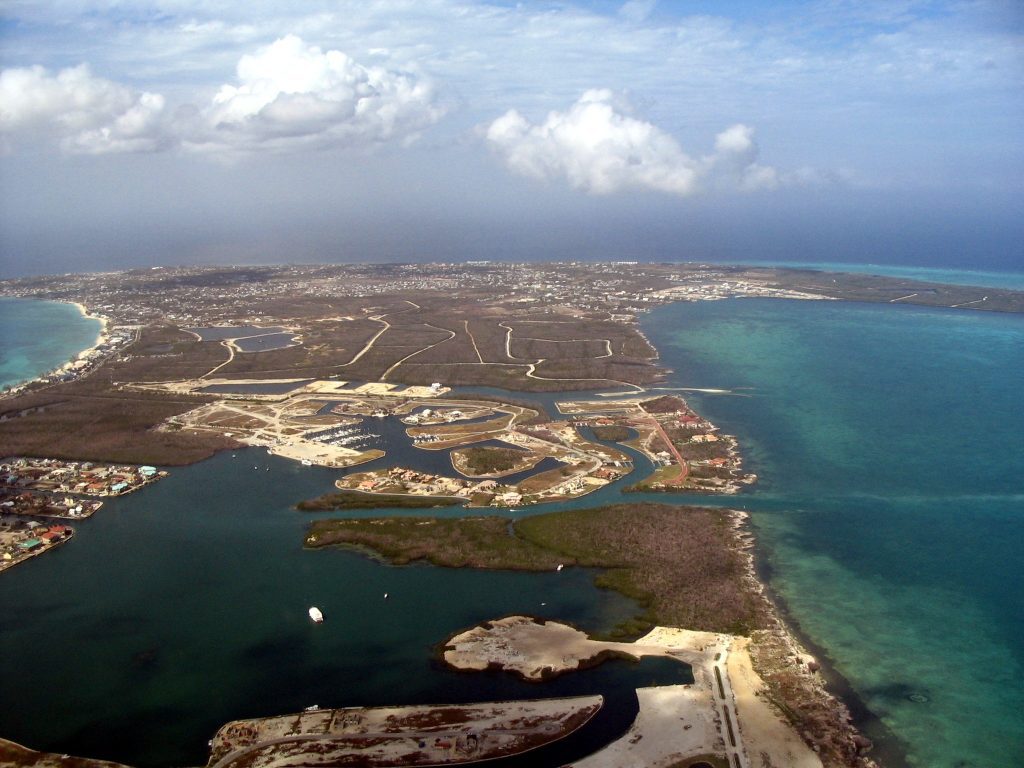
Curacao (Population: 192,077)
In 1634, the Dutch took Curacao from the Spanish. Sadly, it wasn’t until 1863 that the Dutch abolished slavery. It had a severe economic impact on Curacao, which had once been the hub of the Caribbean slave trade. To revitalize its economy, The Isla Refineria was built in the early 20th century.
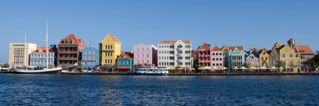
This was employed to handle the newly found Venezuelan oilfields, which brought back its wealth (as well as that of nearby Aruba). The people of Curacao decided to become a sovereign nation inside the Kingdom of the Netherlands in referendums held in 2005 and 2009.
Saint Lucia (Population: 180,251)
The island has been disputed by England and France all through the 17th as well as early 18th centuries (shifting custody 14 times). This was finally given to the UK in 1814 and subsequently became part of the British Windward Islands colony.
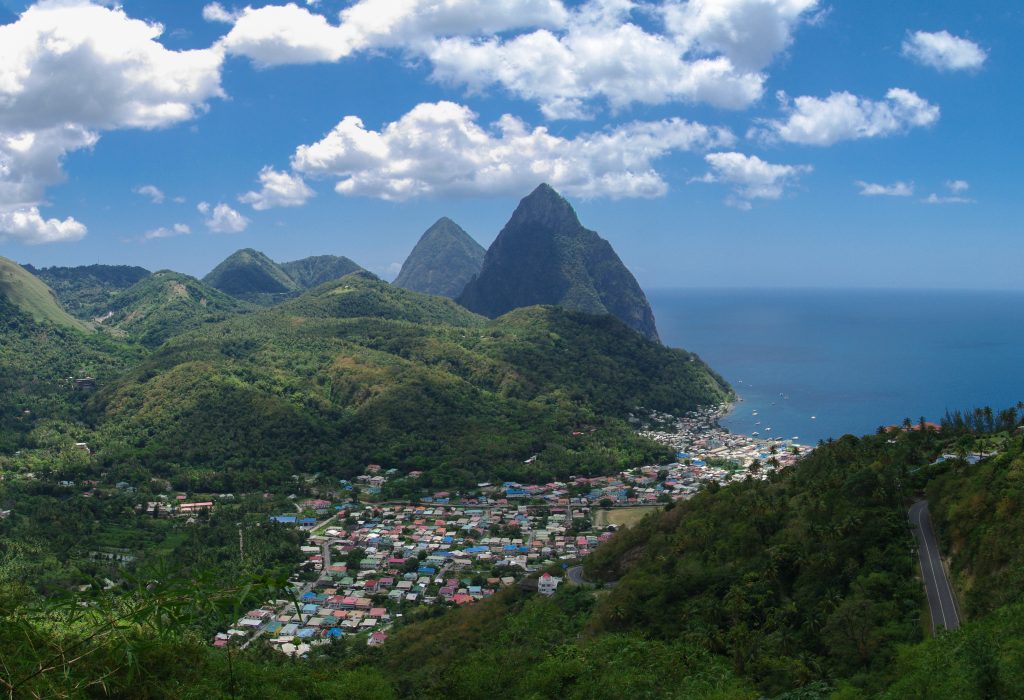
The island, with its beautiful natural port at Castries and rapidly growing sugar industry, was also home to a thriving slave trade. Saint Lucia entered the West Indies Federation in the middle of the twentieth century (1958–1962). Saint Lucia attained complete independence in 1979.
Kiribati (Population: 133,515)
Of the 33 islands that make up Kiribati, just 20 are populated. Stretching from the 16 Gilbert Islands, where the bulk of the population resides, to the three populated Line Islands, Kiribati extends 1,800 miles east of the International Date Line.
Before the International Date Line was moved east of the Line Islands in 1994, not all of the islands of Kiribati shared the same date. On another note, the island nation is one of the leading supporters of marine and climate change protection.
Seychelles (Population: 107,660)
107 square miles make up Seychelles (this makes the country just a bit smaller than Yuma, Arizona). The 95,981 inhabitants of this cluster of islands, positioned 932 miles east of Africa in the Indian Ocean, have been independent of the United Kingdom since 1976.
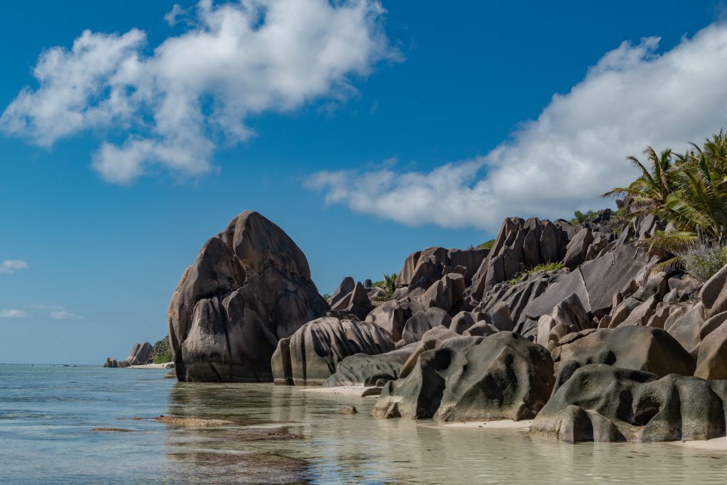
As far as anthropologists can determine, the first humans to settle there were European colonizers in the 16th century. Seychelles is regarded as being the smallest nation in Africa, located northeast of Madagascar. Seychelles is an archipelago of more than 100 tropical islands. Victoria is the largest city and the nation’s capital.
Aruba (Population: 106,277)
Archeological studies have shown human settlements in Aruba as early as 2000 BC. Europeans were unaware of Aruba until 1499, when Spanish explorers “found and claimed” the island. In 1636, the Dutch took possession of it. In 1986, Aruba established itself as a semi-autonomous entity in the Kingdom of the Netherlands.
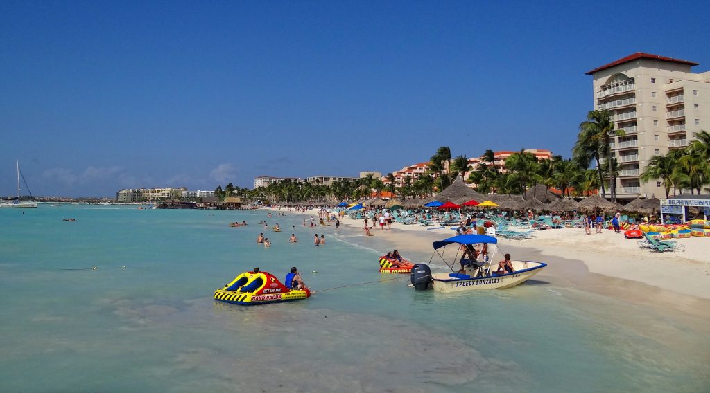
Over the years, the island’s commerce has been characterized by three sectors: gold, oil, and tourism. A gold rush in the 19th century was succeeded by affluence spurred by the building of an oil refinery in 1924. The late 20th century saw tourism grow.
St. Vincent and the Grenadines (Population: 103,698)
Up until 1719, the indigenous Caribs of Saint Vincent resisted colonization. The island was contested by the French and the British for the whole of the 18th century before being “given” over to Britain in 1783. The rich land of Saint Vincent was treasured by the British.

That’s because it supported successful slave-run coffee, sugar, cotton, cocoa, indigo, and tobacco plantations. Saint Vincent and the Grenadines served as a distinct administrative division of the Federation of the West Indies from 1960 and 1962. It gained autonomy in 1969, and independence ten years later in 1979.
Virgin Islands (Population: 98,750)
Throughout the late 17th and early 18th centuries, the Danes established dominance over the southern Virgin Islands, including Saint Thomas, Saint John, and Saint Croix. During most of the 18th and early 19th centuries, the economy of the islands was based on the production of sugarcane.
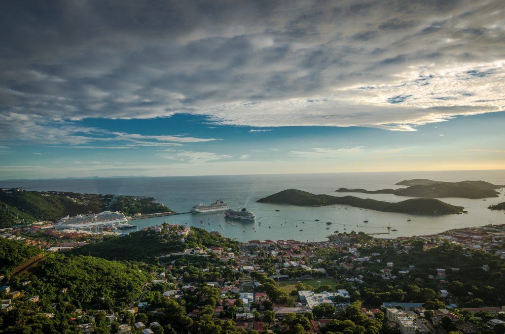
Since the end of slavery in 1848, the Danish estates had been experiencing economic deterioration, and the US bought them in 1917. On September 6, 2017, Hurricane Irma swept over Saint Thomas and Saint John in the northern Virgin Islands, severely damaging the buildings there.
Antigua and Barbuda (Population: 94,298)
Several indigenous people have inhabited the islands over the centuries. In around 2400 BC, the Siboney people resided there, but it was the Arawak Indians who Columbus encountered when he touched down on his second journey in 1493. Since then, England, Spain, and France have held colonies there.
The island took a major economic hit when slavery was banned in 1834, followed by an earthquake and hurricane in 1843 and 1847, respectively. In order to supply workers for the Antiguan sugar plantations, slavery was banned in 1834. In 1981, the islands joined the British Commonwealth of Nations as a sovereign nation.
Isle of Man (Population: 84,710)
The isle belonged to the Norwegian Realm of the Hebrides prior to being transferred to Scotland in the 1200s. At that point, it became a part of Great Britain. The late 20th century saw a push to revive the virtually dead Manx Gaelic language.
The Isle of Man is a British Crown dependence. This means it’s a self-governing territory of the British Crown and is not a component of the United Kingdom. Regardless, the UK Government continues to be legally in charge of the country’s defense and diplomatic presence.
Andorra (Population: 80,088)
The Bishop of Urgel of Spain and the President of France share executive authority over the sovereign Principality of Andorra. This beautiful tourist resort, nestled inside the Pyrenees bordering France and Spain, has been autonomous from the Crown of Aragon since 1278.
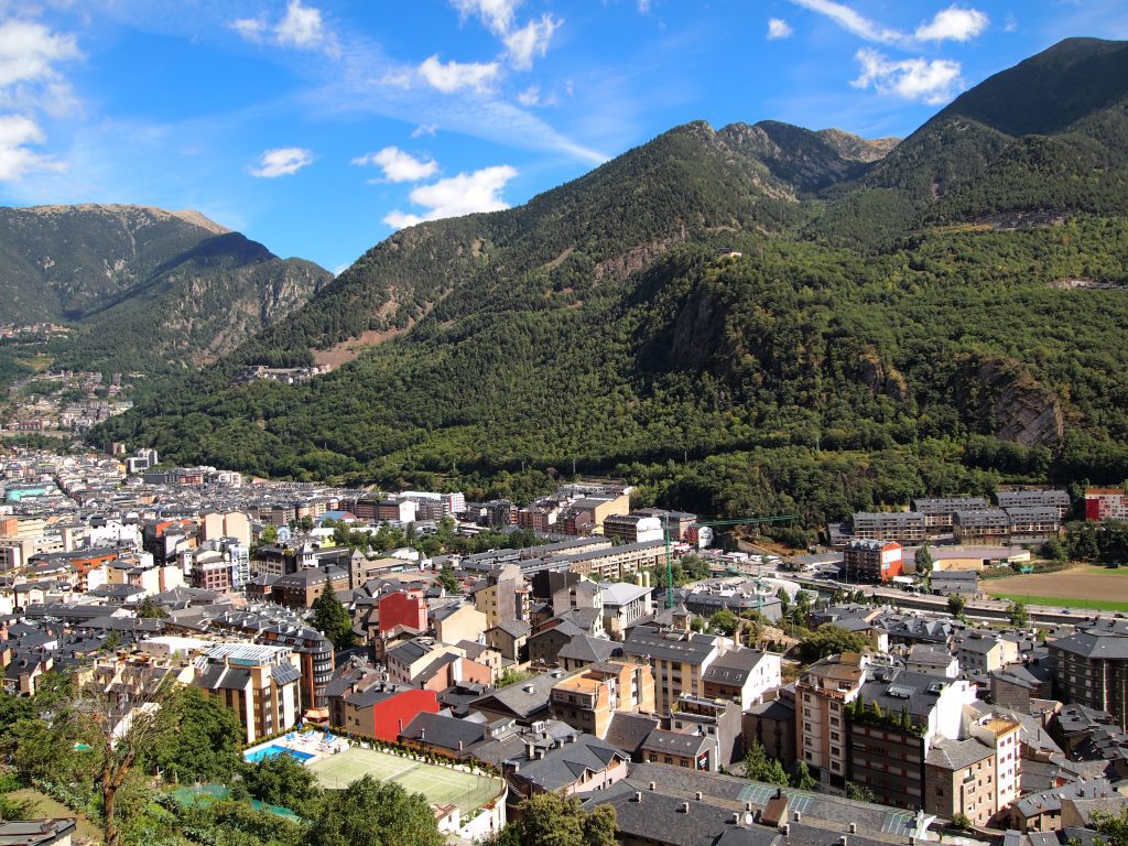
However, it wasn’t until 1814 that it broke free from the French Empire. Currently, Andorra is a symbol of the multiculturalism embraced by the entire European Union, though it’s not a member nation. Roughly 8 million tourists travel to Andorra annually.
Dominica (Population: 73,040)
On this magnificent island, located 60 miles southeast of Saint Kitts and Nevis in the Caribbean, both volcanoes and rainforests coexist. Dominica is a favorite stop for ocean liners due to its architecture, which is saturated with brightly colored homes and floral elements.
Well-groomed hiking routes and timber bridges traverse beneath waterfall features on the heart of the island. Because West Africans were imported as slaves to work on coffee plantations during the late-17th and early-18th centuries, the bulk of the public is of African heritage.
Cayman Islands ( Population: 69,310)
The British settled the Cayman Islands via Jamaica in the eighteenth and nineteenth centuries. Jamaica took over their administration of them in 1863. The islands joined the Federation of the West Indies as a territory in 1959. Today it is still part of the British Overseas Territory.
The region has developed into an important offshore financial hub. Like many of the islands on this list, the water supply comes from desalination facilities and collecting rainwater. One of its claims to fame is being the first Caribbean island to establish marine protected areas.
Bermuda (Population: 64,069)
In 1609, English colonists were heading to Virginia but found themselves stranded in Bermuda. The island had previously been “discovered” by a Spanish explorer in the 16th century, but colonization started only in the 1600s. Interestingly, its prominence as a vacation spot started in the Victorian era.
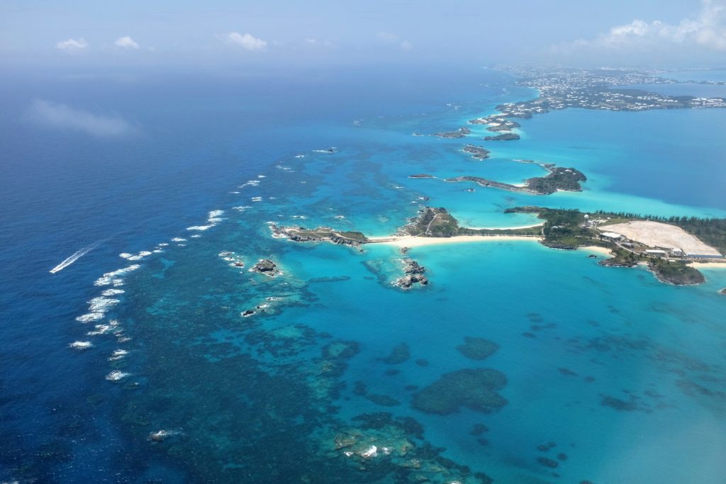
While recent times have seen an increase in the significance of global commerce, tourism still plays a significant role in the island’s economy. Bermuda has likewise grown into a very prosperous offshore financial center. After a failed vote for independence in 1995, Bermuda is still under UK control.
Guernsey (Population: 63,544)
Guernsey and the other Channel Islands are the last holdings of a medieval Duchy of Normandy, that ruled over both France and England. The islands are really the only area of British soil that Nazi forces seized during WW II. Several other islands make up Guernsey’s territory.
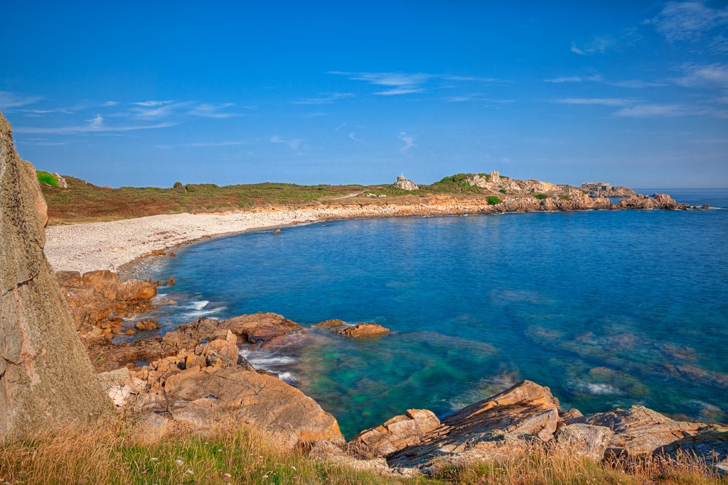
It’s collectively known as the Bailiwick of Guernsey, a self-governing British Crown dependent not a part of the UK. Nonetheless, according to its constitution, the UK Government is in control of the country’s military and diplomatic presence. It’s the second-largest island in the Channel Islands.
Greenland (Population: 56,643)
The majority of Greenland, the biggest island in the world, is covered in ice. In the 10th century, Icelandic Vikings arrived in what is now Greenland. Eight centuries later, the Danish began annexation of the island, before it finally joined the Danish Kingdom in 1953.

The Danish parliament gave Greenland self-government in 1979. Greenland joined the European Community (now the EU) in 1973 alongside Denmark but left in 1985 due to a disagreement over strict fish stocks. Greenland is still a part of the European Union’s Overseas Countries and Territories Association.
Faroe Island (Population: 53,270)
The Faroe Islands were a crucial stopping point during early Viking voyages of the North Atlantic. In the ninth century, Viking settlers landed on the islands. Since the 14th century, the islands have had a political relationship with Denmark. They are now a self-governing dependent of that country.
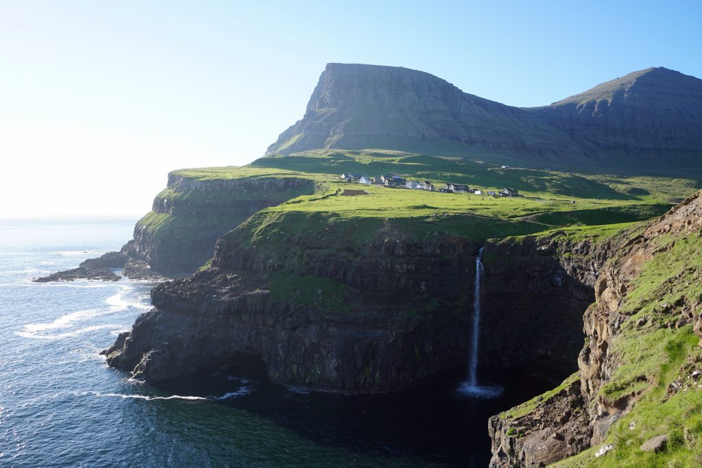
The Faroese were given a great deal of independence by the Home Rule Act of 1948, granting them control over the majority of domestic matters and trade openness. However, Denmark remained in charge of law, security, and certain foreign affairs.
Saint Kitts and Nevis (Population: 47,755)
Saint Kitts and Nevis, an island nation in the Caribbean, has a land area of 104 square miles (marginally smaller than Fresno, California). The nation declared its independence from the UK in 1983. It happens to be the tiniest nation (both in size and population) in the western hemisphere.
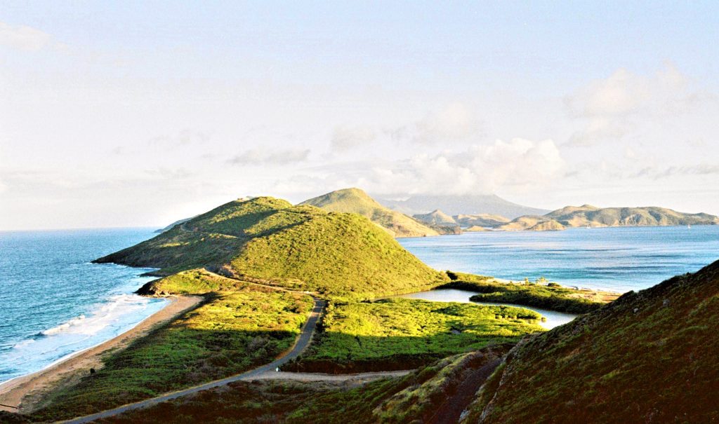
The larger of the two islands, Saint Kitts, stands out in two ways, historically speaking. Also known as “The Mother Colony,” Saint Kitts was one of the first Caribbean lands to be colonized by Europeans. It’s also the last (up to this point) of the British Caribbean teritories to gain independence.
Turks and Caicos (Population: 46,062)
These islands were a component of the British colony of Jamaica till 1962 when Jamaica’s liberation gave them the position of a distinct Crown colony. From 1965 through 1973, the Bahamas’ governor presided over operations. Finally, in 1973, the Bahamas gained its independence.
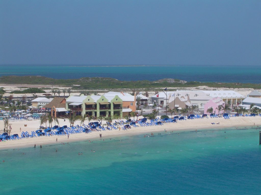
Along with its independence came a new governor. However, it is still considered a British Overseas Territory. The islands are a hotspot for tourism and financial trade, something that is common with many of the small nations on our list.
Sint Maarten (Population: 44,222)
When the Dutch took control of the island in 1631, they started making use of its salt resources. In 1633, the island was retaken by the Spaniards. Once it became a free port, the island’s commerce declined. However, in the 1950s, the tourism sector had a spectacular expansion.
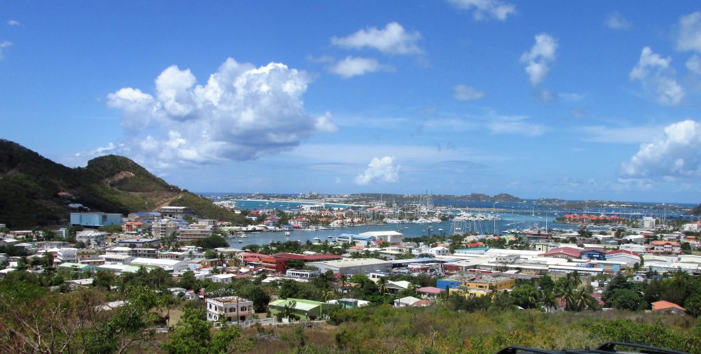
In 1954, the Netherlands Antilles, which included Sint Maarten and a number of other Dutch Caribbean territories, joined the Kingdom of the Netherlands. The people of Sint Maarten decided to secede from the Kingdom of the Netherlands in October 2010.
American Samoa (Population: 43,914)
Not to be confused with Samoa, American Samoa is a territory of the United States, unlike the former which is an independent nation. A plan to formalize the territory’s self-government was made in 1949, yet the United States Congress rejected the proposal with the assistance of local leaders.
American Samoa approved a constitution that gives native Samoan land tenure laws, language, as well as culture considerable safeguards. Currently, the terriroty’s main trade comes from tuna exports, and is a hub for US Army recruitments, with the area having the highest enlistment rates in the US.
Marshall Islands (Population: 41,996)
The Marshall Islands collectively represent the seventh-smallest nation in the world. It is made up of five main islands plus 29 coral atolls that are dispersed across 750,000 square miles of the Pacific Ocean. The Marshall Islands are midway between Hawaii and Australia.
The islands are located close to the cross-section betwee the Equator and the International Date Line. This tiny nation obtained its independence from the United States-run Trust Territory of the Pacific Islands in 1986. Not much is known about the early inhabitants other than their use of stick charts for navigation.
Liechtenstein (Population: 39,584)
The tiny European nation of Liechtenstein is only 62 square miles in size. Unlike most places on this list, it’s entirely landlocked. This small but beautiful nation, which gained independence in 1806, is situated in the mountains between Switzerland and Austria.
Due to financial sturggles, the nation disbanded its military in 1868. And so, during both World Wars, it was mostly impartial and unharmed—in relation to other European nations. Despite being a hereditary constitutional monarchy, the prime minister is in charge of Liechtenstein’s daily operations.
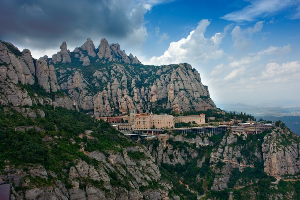
Monaco (Population: 36,297)
Perfectly positioned on the French Riviera, Monaco sits halfway between the Mediterranean Sea and southeast France. Even if you’ve never been there, chances are you’ve heard of Monte Carlo, Monaco’s capital city and arguably the most well-known vacation destination on the planet.
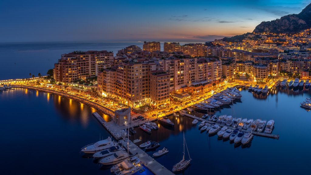
It may be small, but Monaco has many distinguishing features. For starters, it’s the most densly populated soverign state worldwide, and is also one of the wealthiest (and expensive) places in the world. Monaco is the prime example of why size doesn’t matter.
San Marino (Population: 33,642)
San Marino, just like Liechtenstein, is a landlocked country. Hoever, the former is encircled by only one country—Italy. San Marino is situated atop Mount Titano in the region of north-central Italy. Historical records attest that this nation was established in the fourth century.
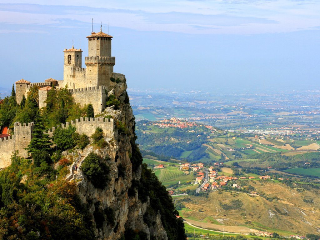
Therefore, San Marino claims to be the oldest state in all of Europe. The majority of San Marino’s geography is made up of rough peaks, with Mount Titano, at 2,477 feet, being the highest point. At 180 feet below sea level, Torrente Ausa is San Marino’s lowest point.
Gibraltar (Population: 32,688)
Given its strategic importance, Spain finally relented to relinquishing Gibraltar to Great Britain in the Treaty of Utrecht in 1713. The former British garrison became officially recognized as a territory in 1830. In 1967, a referrendum was held to determine its potential independence.
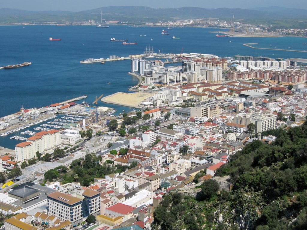
Although Gibraltarians decisively chose to stay a British dependent, they were given autonomy in 1969. In response, Spain decided to close its borders and severed all contact lines with Gibraltar. The UK and Spain undertook a number of discussions about creating temporary joint authority over Gibraltar between 1997 and 2002.
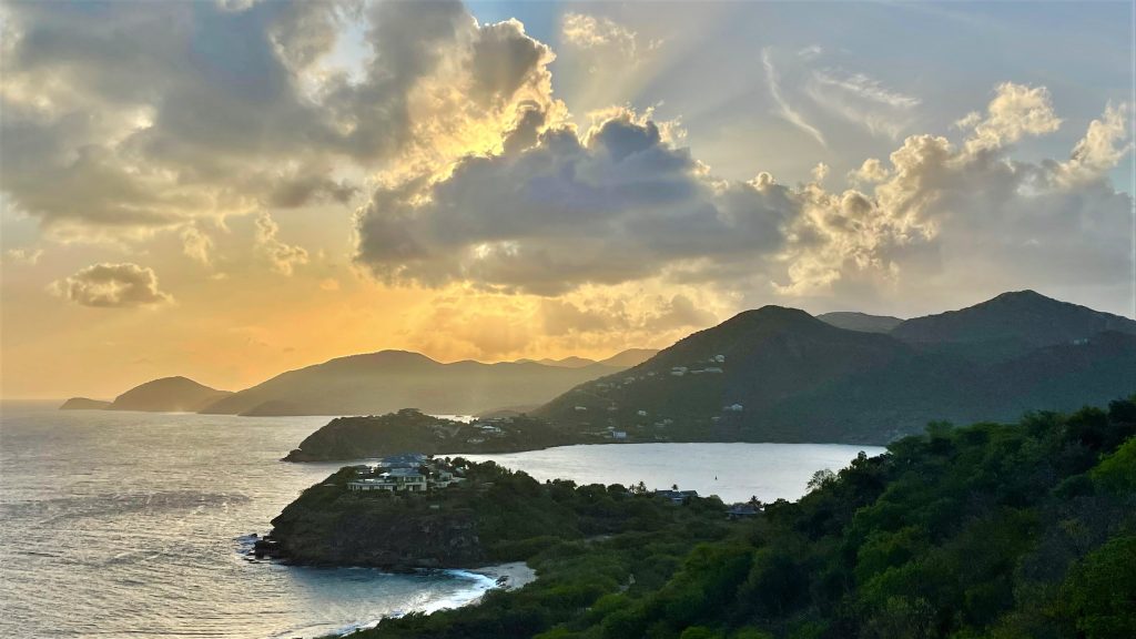
British Virgin Islands (Population: 31,538)
The Virgin Islands were initially populated by Arawak, and later the Carib People. Things got complicated once the Europeans “discovered” the islands. The Dutch settled there in 1648, and the English annexed them in 1672. Between 1872 and 1960, the islands became a part of the British territory of the Leeward Islands.

In 1967, they received independence. Despite being a British terriroty, the British Virgin Islands (officially just the “Virgin Islands”) use US currency. To make things even more confusing, the citizens are technically British, as of 2002. Talk about an identity crisis!
Palau (Population: 18,058)
The island nation of Palau, which was initially inhabited since approximately 2000 BCE, survived the devastating effects of WW 2. The country, which can be located north of Australia and east of the Philippines, was founded in 1994 after a trusteeship with the US.
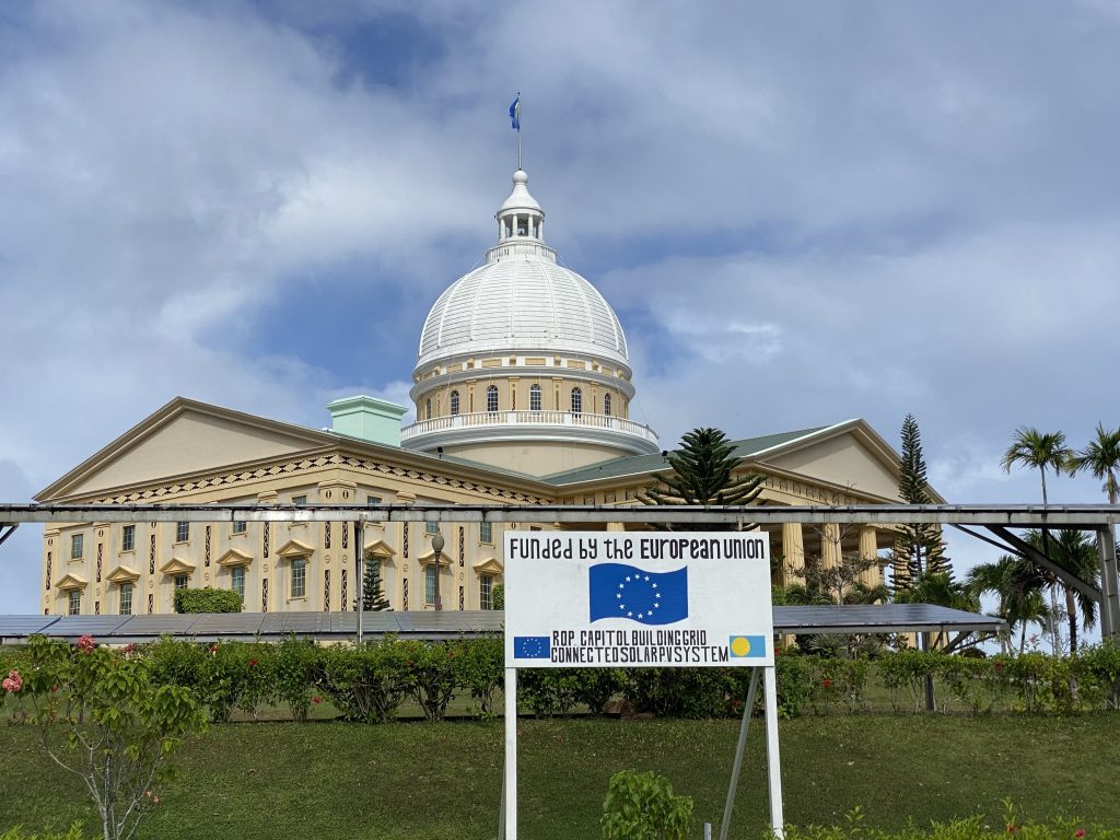
It began in 1947 and came to an end in 1994. From 1914 through 1944, Japan held control of Palau before the United States attacked the country during World War II. Palau consists of over 300 islands, across which there are 2 official, and 3 recognized regional languages.
Cook Islands (Population: 17,044)
Named for the British explorer James Cook, who made land twice in the late 18th century, Cook Islands is a series of 15 islands with only 93 square kilometers to its name. Unfortunately, the Māori name for the nation is just a transliteration of the colonizer’s name.
It started the road to independence in 1962. It still retains strong ties to New Zealand, which the country has free association with. As of 2001, foreign and defense has been handled by the Cook Islands, rather than New Zealand.
Anguilla (Population: 15,899)
Archeologists have found Native American artifacts dating back to 1300 BC, and settlement remains dating back to 600 BC. Though the actual date that Europeans first “discovered” Anguilla is up for debate, the general consesus is that Brits from Saint Kitts were the first colonizers in 1650.
For centuries, Anguilla was under Saint Kitts’ control. There were several failed detachment efforts, including a revolutionary war, over the years. Finally, in 1971, it was given permission to secede. As of 1980, Anguilla, which measures 35 square miles, is a distinct British territory.
Nauru (Population: 12,870)
In Oceania’s South Pacific Ocean lies the remote island nation, Nauru. Covering just 8.1 square miles, Nauru is the smallest island nation on Earth. Formerly known as Pleasant Island, Nauru gained independence in 1968, and joined as a member of the Pacific Community one year later.
Throughout the early 20th century, the nation was renowned for one thing: mining. It had some really successful phosphate mining operations. Perhaps due to its small size, there is no official capital. Its largest district, Denigomodu, was home to around 25% of the country’s population in 1999.
Wallis and Futuna (Population: 11,502)
Up until the landing of US and Free French soldiers in 1942, Wallis and Futuna had been the sole French colony to support the Vichy government during World War II. The islands’ residents decided to secede from New Caledonia via ballot in 1959.
They became a French overseas territory in 1961. Notwithstanding the division, there is still a sizable Wallisian and Futunan presence in New Caledonia. Wallis and Futuna were reclassified as an overseas collectivity in 2003. In 2018, Wallis and Futuna joined the Pacific Islands Forum as associate members.
Tuvalu (Population: 11,396)
There are nine islands that form the nation of Tuvalu, measuring just 10 square miles. The islands were inhabited by Polynesians for thousands of years, spread out across eight of those nine islands. In the Tuvaluan language, the nation’s name means “eight standing together.”
Starting in 1568, when a Spanish explorer landed on the shores, Europeans took interest in the area. In 1978, Tuvalu gained independence from the United Kindgom, and 2000, it joined as a member of the United Nations. Currently, they’re utilizing digital tools to help preserve native cultures in this ever-changing world.
Saint Barthelemy (Population: 10,994)
For years, Saint Barthelemy struggled to break free from the French archipelago, Guadeloupe. Finally, in 2003, they succeeded and Saint Barthelemy is now a French overseas collective. Despite its long French rule, the territory retained the name given by Italian explorer Christopher Columbus in honor of his brother, Bartholomew.

It gained status as an EU overseas territory in 2012, enabling it to exercise local autonomy over the entry of immigrant workers, particularly non-French Europeans, on a permanent and temporary basis. Though the Swedish only had control for a short period of time, Swedish symbology remains on its flag today.
Montserrat (Population: 4,387)
The first colonists to settle on Montserrat were English and Irish immigrants from St. Kitts. The island was contested by the British and French for much of the 18th century before it was officially recognized as British territory in 1783.
Around the mid-19th century, the island’s plantation industry was replaced by tiny farmland holdings. The Soufriere Hills Volcanic explosion, which started on July 18, 1995, left a significant portion of the island in ruins and two-thirds of the people fled the islands.
The Falkland Islands (Population: 3,791)
The Falkland Islands were “discovered” by an English sailor in 1592, but it wasn’t until 1764 that any formal colony was established by French explorers. The was transferred to Spanish control two years later, but there has been an ongoing territorial dispute.
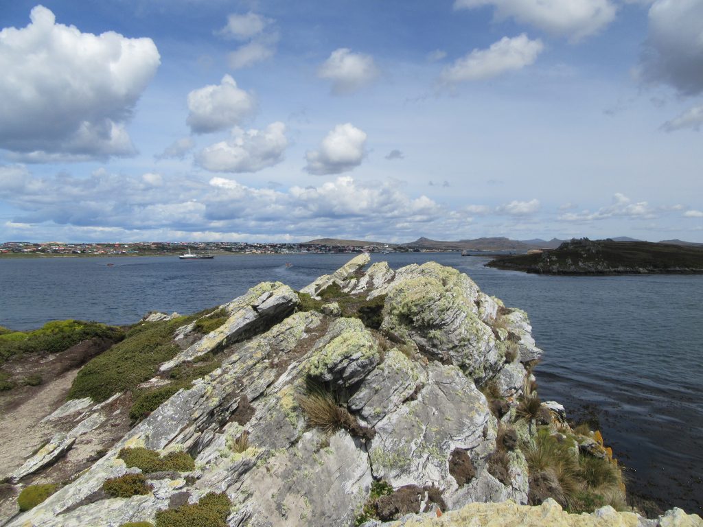
The dispute wasn’t between France and Spain, but rather Spain and Britain, and later Britain and Argentina. On April 2, 1982, Argentina stormed the islands. Following a heavy battle, the British expeditionary force that descended seven weeks later secured an Argentine total surrender on June 14, 1982.
Niue (Population: 1,935)
Niue became a component of the Cook Islands and was acquired by New Zealand in 1901. Due to its isolation from the Cook Islands and ethnic and linguistic distinctions, Niue was given its own governance by New Zealand in 1904. The island gained domestically self-governing in 1974.
It has a free association with New Zealand, which is in charge of foreign and military affairs, but it is a separate participant in global organizations. Niue has few chances for economic growth. With significant outflow to New Zealand in recent years, the population has been declining.
Tokelau (Population: 1,893)
About the year 1000 AD, Polynesians originally established Tokelau, a group of three atolls. The three atolls ran their businesses largely autonomously of one another, but they did interact, intermarry, and sometimes start battles. Both Protestant and Catholic missionaries served in Fakaofo, where the populace is more diverse.

But, Nukunonu is still primarily Catholic and Atafu is primarily Protestant. Tokelau has few economic prospects, and the majority of its citizens move to New Zealand. Tokelau doesn’t have an airstrip and can only be reached from Samoa by daylong boat travel.
Vatican City (Population: 518)
Vatican City maintains the distinction of being the world’s tiniest nation. It seats the Pope and functions as the intellectual hub of the Catholic Church. The Holy See, often known as Vatican City, is a fortified section of Rome, the national capital of Italy.

The Lateran Treaty made with Italy gave the tiny nation its formal birth in 1929. It has an ecclesiastical system of governance, and the Pope is effectively its head of state. Through the decision, Vatican City has opted out of membership in the UN.